Latitude: 53.1448 / 53°8'41"N
Longitude: -2.9402 / 2°56'24"W
OS Eastings: 337211
OS Northings: 361268
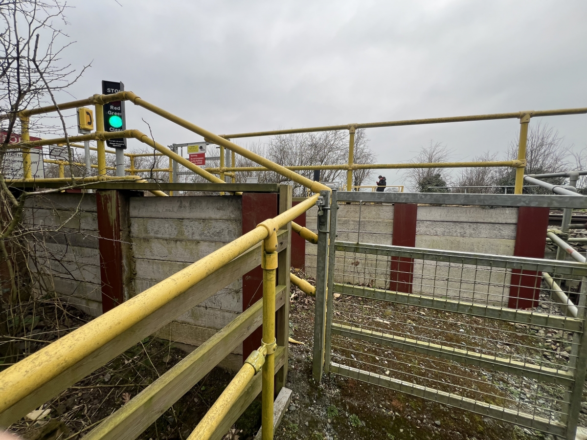
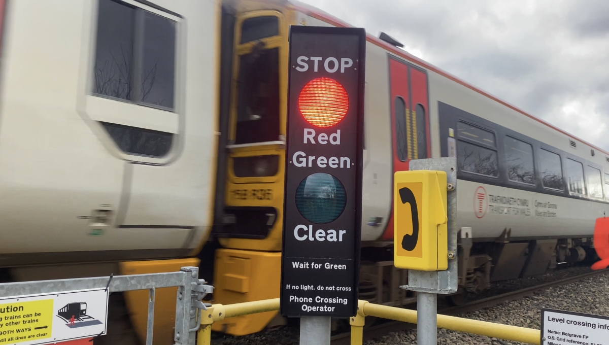
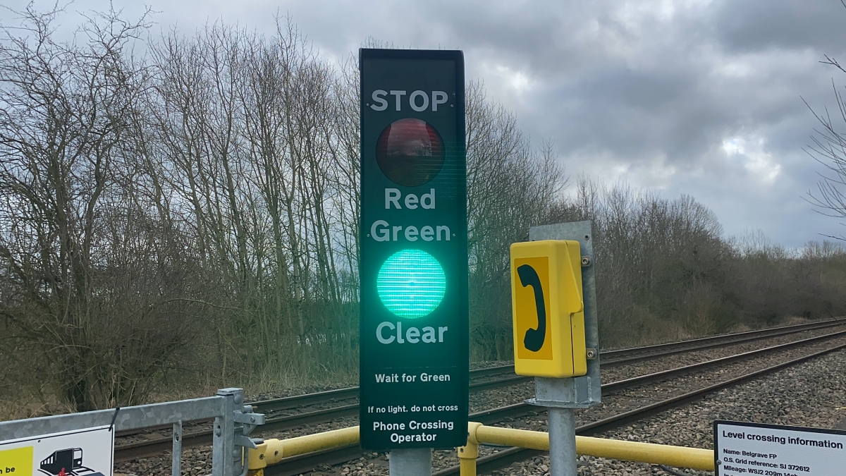
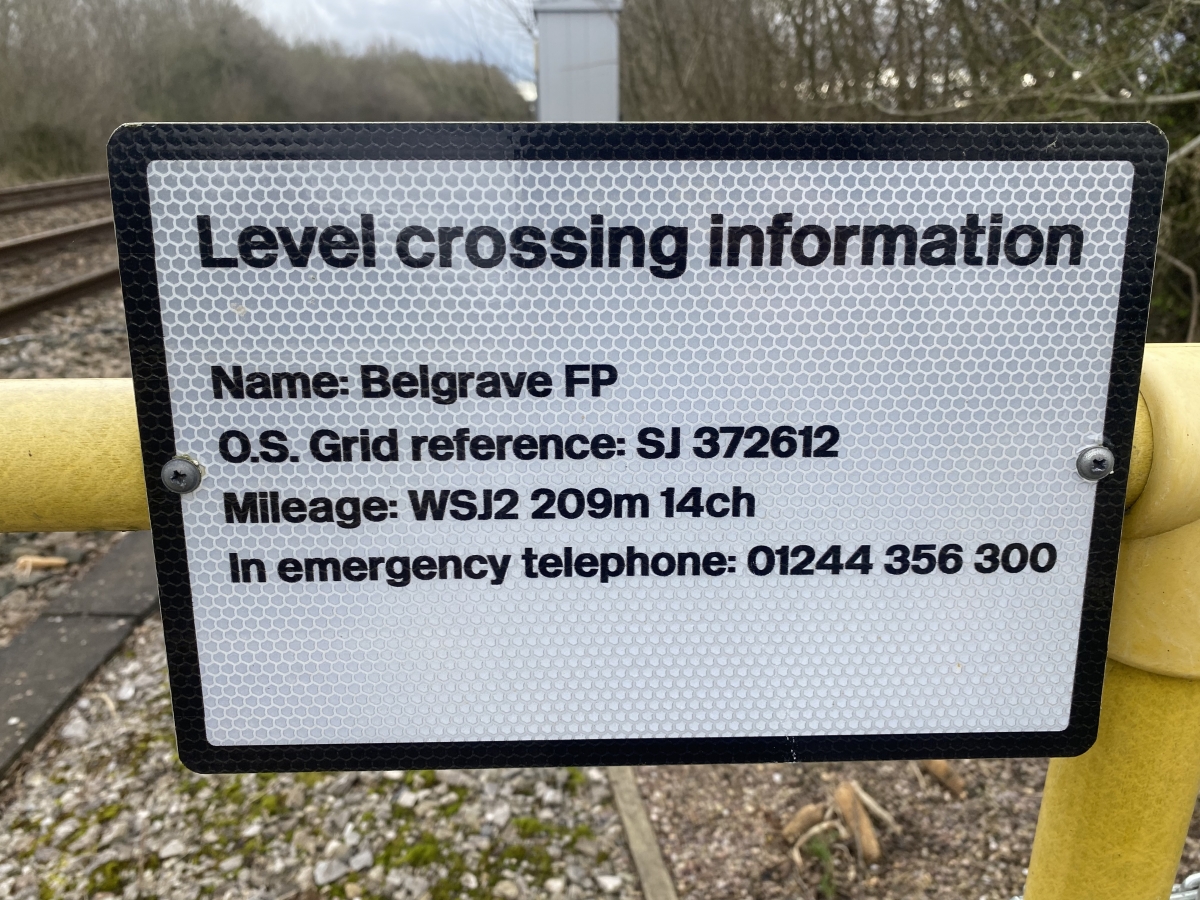
OS Grid: SJ372612
Mapcode National: GBR 78.5SBZ
Mapcode Global: WH88L.T63Y
Pluscode: 9C5V43V5+WW
What3Words: cackling.devoured.traders
Is the location marker in the wrong place? You can help fix that!