Latitude: 53.3673 / 53°22'2"N
Longitude: -2.0992 / 2°5'57"W
OS Eastings: 393497
OS Northings: 385613
OS Grid: SJ934856
Mapcode National: GBR FYSH.BM
Mapcode Global: WHBB3.QMLD
Pluscode: 9C5V9W82+W8
What3Words: assets.tastier.economics
Is the location marker in the wrong place? You can help fix that!
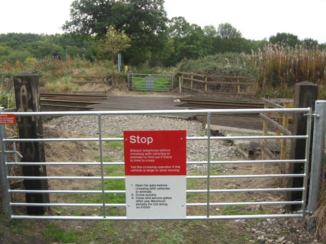
We don't yet have any user-contributed photos of Mill Farm/towers Farm Level Crossing.