Latitude: 55.9728 / 55°58'21"N
Longitude: -4.6832 / 4°40'59"W
OS Eastings: 232651
OS Northings: 678781
OS Grid: NS326787
Mapcode National: GBR 0G.WPW1
Mapcode Global: WH2MC.145J
Pluscode: 9C7QX8F8+4P
What3Words: cemented.overture.adults
Is the location marker in the wrong place? You can help fix that!
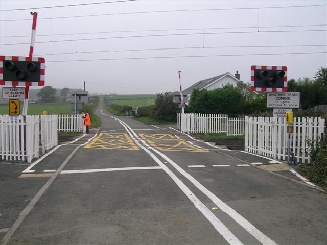
We don't yet have any user-contributed photos of Ardmore East Level Crossing.