Latitude: 52.6269 / 52°37'36"N
Longitude: -1.2192 / 1°13'9"W
OS Eastings: 452946
OS Northings: 303524
OS Grid: SK529035
Mapcode National: GBR 8MJ.BL3
Mapcode Global: WHDJH.77NH
Pluscode: 9C4WJQGJ+Q8
What3Words: rails.ashes.takes
Is the location marker in the wrong place? You can help fix that!
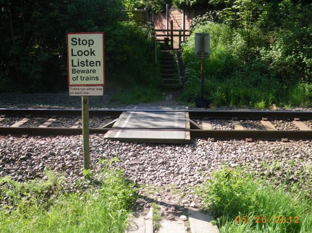
We don't yet have any user-contributed photos of Golf Course Level Crossing.