Latitude: 54.2083 / 54°12'29"N
Longitude: -3.2942 / 3°17'39"W
OS Eastings: 315685
OS Northings: 479941
OS Grid: SD156799
Mapcode National: GBR 5MFS.L6
Mapcode Global: WH722.CHK7
Pluscode: 9C6R6P54+88
What3Words: solid.miracle.screening
Is the location marker in the wrong place? You can help fix that!
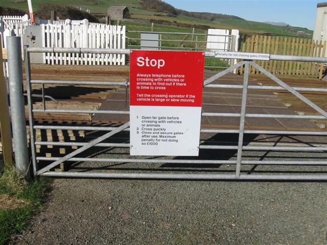
We don't yet have any user-contributed photos of Haverigg Cattle Crossing Level Crossing.