Latitude: 52.628 / 52°37'40"N
Longitude: -1.2313 / 1°13'52"W
OS Eastings: 452127
OS Northings: 303642
OS Grid: SK521036
Mapcode National: GBR 8MJ.7HJ
Mapcode Global: WHDJH.16YM
Pluscode: 9C4WJQH9+6F
What3Words: richer.beyond.doctor
Is the location marker in the wrong place? You can help fix that!
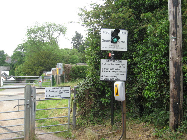
We don't yet have any user-contributed photos of Kirby Muxloe Level Crossing.