Latitude: 50.8755 / 50°52'31"N
Longitude: -2.8186 / 2°49'6"W
OS Eastings: 342500
OS Northings: 108764
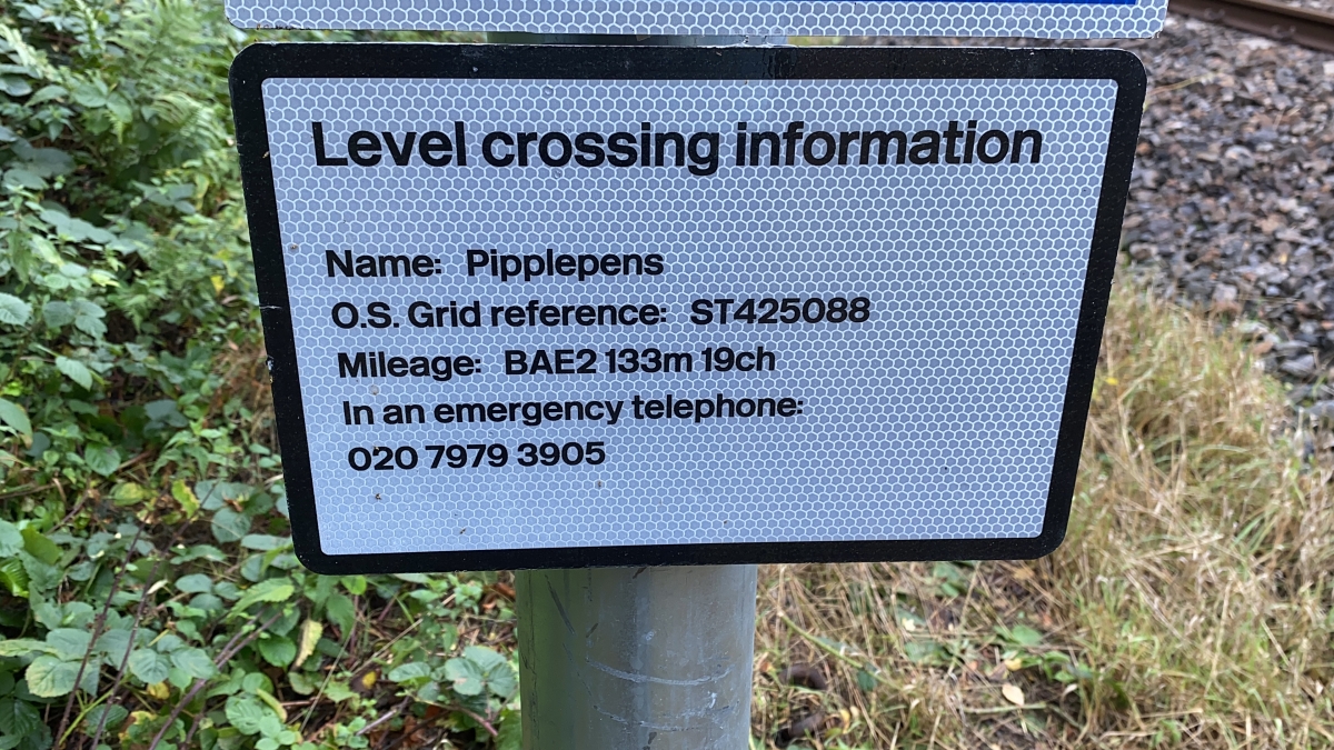
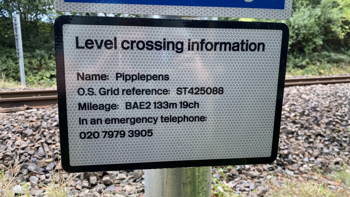
OS Grid: ST425087
Mapcode National: GBR MF.T1QT
Mapcode Global: FRA 46ZS.HQF
Pluscode: 9C2VV5GJ+6H
What3Words: charcoal.sloping.reporting
Is the location marker in the wrong place? You can help fix that!